
Interested in advertising on Derpibooru? Click here for information!

Help fund the $15 daily operational cost of Derpibooru - support us financially!
Description
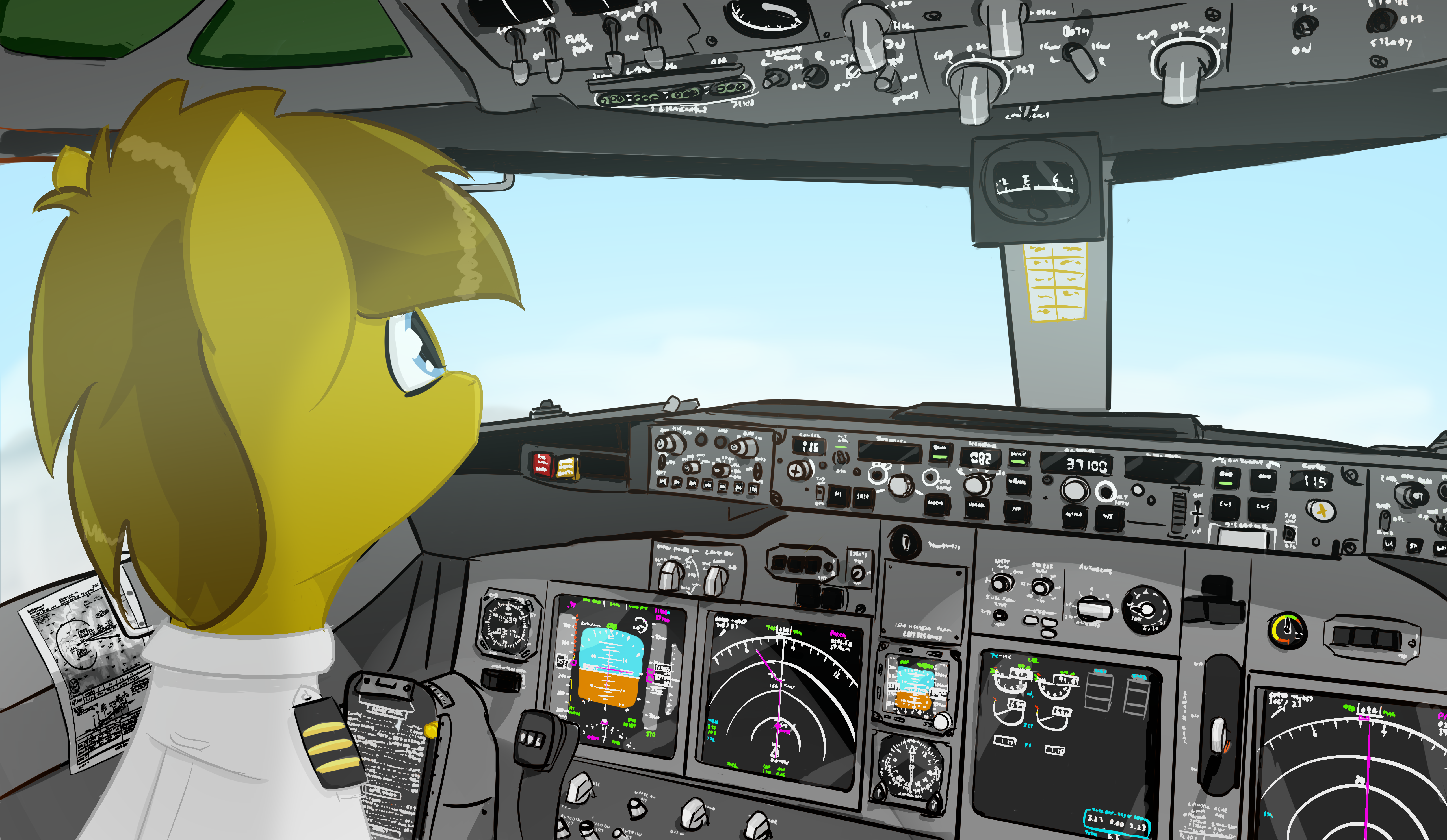
Would be very impressed if someone can work out where we’re flying into. Several clues worked out in logical steps.
he doesnt even have a PPL lmao
Probably. He’s s pilot in real life
Ever heard of line training?
Why am I not surprised…
In all seriousness though that’s a good representation of a 737 cockpit. Nice job.
Solution:
Step 1. From the altitude window, 37100 and the PFD having metres mode up, we know we are flying metric flight levels, so either Russia or China, likely China since Russia has implemented ICAO flight levels in feet since 2015.
Step 2. From the minimums setting, we can see that it’s in BARO and is 10390 (or 5 digits, above 10,000 ft if you can’t read it). So either the Andes or the Himalayas. From step 1, we can narrow it down to Tibet.
Step 3. This one is difficult. There are only a few airports in Tibet which support CAT C (D in vis CTL. From the chart, we can see that it’s an ILS IAP. If we compare plates (difficult to find public Chinese approach plates), we can identify by comparison, or by observation, an ILS for a runway 26, would give the answer of ZULS, Lhasa GongGar.
I did learn a lot about aircraft navigation just now though.